Commons:Graphic Lab/Map workshop
| Illustration Workshop | Map Workshop | Photography Workshop | Video and Sound Workshop |
 Map workshop
This workshop is part of the Graphics Lab, a project aimed at picture retouching to improve the graphical content of the Wikimedia projects. More information about the lab can be found on its main page and requests pages (Illustrations ; Photographs ; Maps ; Video and Sound). To ask questions or make a suggestions, see the talk page of the graphic lab page.
This specific page is the requests page for the Map Workshop. Anyone can make a request for a map to be created or improved. The standard format for making a request is shown below, along with general advice, and should be followed.
Make a request
Use the following template when making a new request, replacing the examples with your image(s) and request(s):
<gallery>
 IMAGENAME.EXT|Description of image
 IMAGE#TWO.EXT|2nd image (If there is one)
 ETCETCETC.EXT|Don't request too many at once, though
</gallery>

;Request:
: Details of your request go here… --~~~~
;Graphist opinion(s):
See also
[edit]| SpBot archives all sections tagged with {{Section resolved|1=~~~~}} after 7 days and sections whose most recent comment is older than 185 days. For the archive overview, see /Archive. The latest archive is located at /Archive/2024. | |
Incorrect/missing colors of waterbodies
[edit]
Article(s): en:Vironniemi
- Request
- The map above is just an example; there are probably 100+ of these maps with incorrect/missing waterbody colors on maps of Helsinki. File:Helsinki districts.svg is the base map file and has the correct coloring; please compare it to the image above. Those incorrect maps were made by User:Stadscykel who later fixed some of them (e.g. Special:Diff/43585007, Special:Diff/43585930), but most of those maps still have incorrect/missing colors. Related discussions on fi.wikipedia: link and link, and here on Commons: link. --JAAqqO (talk) 01:06, 31 December 2023 (UTC)
- If someone ever decides to fix these, here is a list of 130 map files that need fixing:
- File:Alppiharju-Åshöjden.sijainti-läge.svg
- File:Alppila-Alphyddan.sijainti-läge.svg
- File:Aluemeri-Territorialhavet.sijainti-läge.svg
- File:Aurinkolahti-Solvik.sijainti-läge.svg
- File:Eira.sijainti-läge.svg
- File:Hakuninmaa-Håkansåker.sijainti-läge.svg
- File:Haltiala-Tomtbacka.sijainti-läge.svg
- File:Harju-Ås.sijainti-läge.svg
- File:Heikinlaakso-Henriksdal.sijainti-läge.svg
- File:Herttoniemen_teollisuusalue-Hertonäs_industriområde.sijainti-läge.svg
- File:Hevossalmi-Hästnässund.sijainti-läge.svg
- File:Itä-Pakila-Östra_Baggböle.sijainti-läge.svg
- File:Itä-Pasila-Östra_Böle.sijainti-läge.svg
- File:Itäkeskus-Östra_centrum.sijainti-läge.svg
- File:Itäsaaret-Östra_holmarna.sijainti-läge.svg
- File:Jätkäsaari-Busholmen.sijainti-läge.svg
- File:Jakomäki-Jakobacka.sijainti-läge.svg
- File:Jollas.sijainti-läge.svg
- File:Käpylä-Kottby.sijainti-läge.svg
- File:Kaarela-Kårböle.sijainti-läge.svg
- File:Kaartinkaupunki-Gardesstaden.sijainti-läge.svg
- File:Kaivopuisto-Brunnsparken.sijainti-läge.svg
- File:Kallahti-Kallvik.sijainti-läge.svg
- File:Kamppi-Kampen.sijainti-läge.svg
- File:Kannelmäki-Gamlas.sijainti-läge.svg
- File:Karhusaari-Björnsö.sijainti-läge.svg
- File:Katajanokka-Skatudden.sijainti-läge.svg
- File:Keski-Pasila-Mellersta_Böle.sijainti-läge.svg
- File:Keski-Vuosaari-Mellersta_Nordsjö.sijainti-läge.svg
- File:Kivihaka-Stenhagen.sijainti-läge.svg
- File:Kivikko-Stensböle.sijainti-läge.svg
- File:Kluuvi-Gloet.sijainti-läge.svg
- File:Konala-Kånala.sijainti-läge.svg
- File:Kontula-Gårdsbacka.sijainti-läge.svg
- File:Koskela-Forsby.sijainti-läge.svg
- File:Kruununhaka-Kronohagen.sijainti-läge.svg
- File:Kuninkaantammi-Kungseken.sijainti-läge.svg
- File:Kurkimäki-Tranbacka.sijainti-läge.svg
- File:Länsi-Pakila-Västra_Baggböle.sijainti-läge.svg
- File:Länsi-Pasila-Västra_Böle.sijainti-läge.svg
- File:Länsisaaret-Västra_holmarna.sijainti-läge.svg
- File:Laajasalo-Degerö.sijainti-läge.svg
- File:Laakso-Dal.sijainti-läge.svg
- File:Landbo.sijainti-läge.svg
- File:Lassila-Lassas.sijainti-läge.svg
- File:Latokartano-Ladugården.sijainti-läge.svg
- File:Linjat-Linjerna.sijainti-läge.svg
- File:Malmi-Malm.sijainti-läge.svg
- File:Malminkartano-Malmgård.sijainti-läge.svg
- File:Malmin_lentokenttä-Malms_flygfält.sijainti-läge.svg
- File:Marjaniemi-Marudd.sijainti-läge.svg
- File:Marttila-Martas.sijainti-läge.svg
- File:Maunula-Månsas.sijainti-läge.svg
- File:Maunulanpuisto-Månsasparken.sijainti-läge.svg
- File:Meri-Rastila-Havsrastböle.sijainti-läge.svg
- File:Metsälä-Krämertsskog.sijainti-läge.svg
- File:Munkkisaari-Munkholmen.sijainti-läge.svg
- File:Munkkivuori-Munkshöjden.sijainti-läge.svg
- File:Mustavuori-Svarta_backen.sijainti-läge.svg
- File:Mustikkamaa-Korkeasaari-Blåbärslandet-Högholmen.sijainti-läge.svg
- File:Niemenmäki-Näshöjden.sijainti-läge.svg
- File:Niinisaari-Bastö.sijainti-läge.svg
- File:Nordsjön_kartano-Nordsjö_gård.sijainti-läge.svg
- File:Oulunkylä-Åggelby.sijainti-läge.svg
- File:Pajamäki-Smedjebacka.sijainti-läge.svg
- File:Pakila-Baggböle.sijainti-läge.svg
- File:Paloheinä-Svedängen.sijainti-läge.svg
- File:Pasila-Böle.sijainti-läge.svg
- File:Patola-Dammen.sijainti-läge.svg
- File:Pihlajamäki-Rönnbacka.sijainti-läge.svg
- File:Pihlajisto-Rönninge.sijainti-läge.svg
- File:Pirkkola-Britas.sijainti-läge.svg
- File:Pitäjänmäen_teollisuusalue-Sockenbacka_industriområde.sijainti-läge.svg
- File:Pitäjänmäki-Sockenbacka.sijainti-läge.svg
- File:Pohjois-Haaga-Norra_Haga.sijainti-läge.svg
- File:Pohjois-Pasila-Norra_Böle.sijainti-läge.svg
- File:Puistola-Parkstad.sijainti-läge.svg
- File:Pukinmäki-Bocksbacka.sijainti-läge.svg
- File:Punavuori-Rödbergen.sijainti-läge.svg
- File:Puotila-Botby_gård.sijainti-läge.svg
- File:Puotinharju-Botbyhöjden.sijainti-läge.svg
- File:Puroniitty-Bäckängen.sijainti-läge.svg
- File:Rastila-Rastböle.sijainti-läge.svg
- File:Reimarla-Reimars.sijainti-läge.svg
- File:Roihupellon_teollisuusalue-Kasåkers_industriområde.sijainti-läge.svg
- File:Roihuvuori-Kasberget.sijainti-läge.svg
- File:Ruskeasuo-Brunakärr.sijainti-läge.svg
- File:Salmenkallio-Sundberg.sijainti-läge.svg
- File:Santahamina-Sandhamn.sijainti-läge.svg
- File:Siltamäki-Brobacka.sijainti-läge.svg
- File:Siltasaari-Broholmen.sijainti-läge.svg
- File:Suomenlinna-Sveaborg.sijainti-läge.svg
- File:Suurmetsä-Storskog.sijainti-läge.svg
- File:Suutarila-Skomakarböle.sijainti-läge.svg
- File:Töyrynummi-Lidmalmen.sijainti-läge.svg
- File:Tahvonlahti-Stansvik.sijainti-läge.svg
- File:Tali.sijainti-läge.svg
- File:Talinranta-Talistranden.sijainti-läge.svg
- File:Talosaari-Husö.sijainti-läge.svg
- File:Tammisalo-Tammelund.sijainti-läge.svg
- File:Tapanila-Mosabacka.sijainti-läge.svg
- File:Tapaninkylä-Staffansby.sijainti-läge.svg
- File:Tapaninvainio-Staffansslätten.sijainti-läge.svg
- File:Tapulikaupunki-Stapelstaden.sijainti-läge.svg
- File:Tattariharju-Tattaråsen.sijainti-läge.svg
- File:Tattarisuo-Tattarmossen.sijainti-läge.svg
- File:Torkkelinmäki-Torkelsbacken.sijainti-läge.svg
- File:Torpparinmäki-Torparbacken.sijainti-läge.svg
- File:Toukola-Majstad.sijainti-läge.svg
- File:Tullisaari-Turholm.sijainti-läge.svg
- File:Tuomarinkartano-Domargård.sijainti-läge.svg
- File:Tuomarinkylä-Domarby.sijainti-läge.svg
- File:Ulkosaaret-Utöarna.sijainti-läge.svg
- File:Ullanlinna-Ulrikasborg.sijainti-läge.svg
- File:Ultuna.sijainti-läge.svg
- File:Uutela-Nybondas.sijainti-läge.svg
- File:Vallila-Vallgård.sijainti-läge.svg
- File:Vartioharju-Botbyåsen.sijainti-läge.svg
- File:Vartiokylä-Botby.sijainti-läge.svg
- File:Vartiosaari-Vårdö.sijainti-läge.svg
- File:Veräjälaakso-Grinddal.sijainti-läge.svg
- File:Veräjämäki-Grindbacka.sijainti-läge.svg
- File:Vesala-Ärvings.sijainti-läge.svg
- File:Viikinmäki-Viksbacka.sijainti-läge.svg
- File:Viikin_tiedepuisto-Viks_forskarpark.sijainti-läge.svg
- File:Villinki-Villinge.sijainti-läge.svg
- File:Vironniemi-Estnäs.sijainti-läge.svg
- File:Vuosaari-Nordsjö.sijainti-läge.svg
- File:Ylä-Malmi-Övre_Malm.sijainti-läge.svg
- File:Östersundom.sijainti-läge.svg
- Graphist opinion(s)
- JAAqqO, please check the sample you highlighted which I have uploaded a new version of. If correct, the good news is that it is easy to recreate each map from the base File:Helsinki districts.svg (of course, the bad news is there are 130). Chipmunkdavis (talk) 02:03, 26 June 2024 (UTC)
- Chipmunkdavis, yes, that one looks good now, thank you. --JAAqqO (talk) 04:39, 1 July 2024 (UTC)
- One of the discussions you linked mentions the colours are a poor choice for colour-blind users, may be worth considering that too before editing 130 files. Chipmunkdavis (talk) 02:07, 26 June 2024 (UTC)
A Map for the Ajuran Sultanate
[edit]-
Description of first image
-
Description of second image (if needed)
-
Description of third image (if needed; don't request too many at once, though)
Ajuran Sultanate: [[]]
- Request
- (details of your request go here...) --Karamumkaram (talk) 14:04, 7 April 2024 (UTC) The map needs to be based on the one from [[1]]
- I've also requested one of the Horn of Africa c. 13th century which might include Ajuran Kowal2701 (talk) 19:35, 21 July 2024 (UTC)
- Graphist opinion(s)
Updating EU maps with the UK
[edit],_administrative_divisions_-_de_-_colored_(EU_labeled).svg)
,_administrative_divisions_-_de_-_colored.svg)
,_administrative_divisions_-_ISO3166_-_colored_(EU_labeled).svg)
,_administrative_divisions_-_ISO3166_-_colored.svg)
,_administrative_divisions_-_Nmbrs_-_colored_(EU_labeled).svg)
,_administrative_divisions_-_Nmbrs_-_colored.svg)
,_administrative_divisions_-_de_-_colored_(marker).svg)
,_administrative_divisions_-_de_-_colored_(multizoom).svg)
,_administrative_divisions_-_Nmbrs_-_colored_(marker).svg)
,_administrative_divisions_-_Nmbrs_-_colored_(multizoom).svg)
.svg)

.svg)

.svg)

- Request
- These maps of the European Union (and likely more! this I found in the same category) still have the United Kingdom, despite it having leaving years ago. --Juwan (talk) 17:00, 6 May 2024 (UTC)
- Graphist opinion(s)
- If there are a lot you could consider creating a category like Category:Maps needing South Sudan political boundaries. Chipmunkdavis (talk) 04:40, 26 June 2024 (UTC)
- I've added the above maps to Category:Maps of the current European Union with the United Kingdom. Chipmunkdavis (talk) 13:50, 28 June 2024 (UTC)
Ability to distinguish "D" (for decriminalized) on US map on cell phones
[edit]Please see: Wikipedia talk:WikiProject Maps#Ability to distinguish "D" on map on cell phones. We need some more participants. See map in article (at top right):
--Timeshifter (talk) 11:10, 2 July 2024 (UTC)
Map of the Second Polish Republic superimposed on modern borders
[edit]-
 Map that could serve as a model as a request

Article(s): en:Second Polish Republic, en:Territorial evolution of Poland, etc
- Request
- Could someone make an svg map of the borders of the Second Polish Republic as of 1929 superimposed on modern European borders? Two versions would be best, one blank and one with locations and names of important cities that either was previously inside Poland (like Lviv and Vilnius) and cities that became a part of Poland after World War II (like Wrocław)? --Colohisto (talk) 05:45, 4 July 2024 (UTC)
- Graphist opinion(s)
Poland 2024 local government authorities
[edit]-
Description of first image
-
Description of second image (if needed)
-
Description of third image (if needed; don't request too many at once, though)
Article(s): pl:Zarządy województw VII kadencji
- Request
- I would like to ask someone to create map for local goverment authorities aftes 2024 local election in Poland, there is example for map https://commons.wikimedia.org/wiki/File:Władze_na_szczeblu_wojewódzkim_(2018).svg
to do this map i would let the colours to use and abbrevation:
Dolnośląskie KO-TD-BS Kujawsko-Pomorskie KO-TD Lubelskie PiS Lubuskie KO-TD Łódzkie KO-TD-Lewica Małopolskie PiS Mazowieckie KO-TD Opolskie KO-ŚS-TD Podkarpackie PiS Podlaskie KO-TD Pomorskie KO-TD Śląskie KO-TD-Lewica Świętokrzyskie PiS Warmińsko-Mazurskie KO-TD Wielkopolskie KO-TD-Lewica Zachodniopomorskie KO-TD-Lewica
colours: KO E19F39 TD 96D544 BS BS2023 PiS 073A76 Lewica ac145a ŚS 0D2E51
--Aight 2009 (talk) 00:44, 13 July 2024 (UTC)
- Graphist opinion(s)
Removal of Eastern European Summer Time in Ukraine
[edit]-
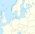
 Time zone map of Greater Europe

Article(s): en:Summer time in Europe
- Request
- starting October 27, Ukraine will no longer observe summer time (sources in article above). it means that Ukraine will be coloured yellow instead of ochre. technicalities: Russian-occupied regions follow a different separate time zone (UTC+03:00) all year round (fact-check?). see file page for more information. --Juwan (talk) 14:26, 16 July 2024 (UTC)
- @Si Vonne: Hi, I noticed that you updated Ukraine in the above image. As stated in en:Time in Russia#Russian Federation, all Russian-occupied regions claimed by Ukraine (Crimea, Donetsk, Kherson, Luhansk and Zaporizhzhia) are on Moscow Time. I think they should be shaded in alternating green and yellow like on this map. What do you think? Qzekrom (talk) 04:54, 30 July 2024 (UTC)
- Graphist opinion(s)

Article(s): Numerous articles in different languages across Wikipedia.
- Request
- File:UN member states animation.gif needs to be updated by including South Sudan, which became independent on 9 July 2011 and became a UN member on 14 July 2011, which remains the newest country and UN member today. --Oirattas (talk) 22:58, 16 July 2024 (UTC)
- Graphist opinion(s)
Horn of Africa (Ifat and Ethiopia) c. 1300
[edit]Article(s): en:History of Africa, en:Africa
- Request
- Really just the Ifat Sultanate and Ethiopia is needed, but if you could include Ajuran and Warsangali in the corner that'd be grand. There are images on wikicommons of all of these that can be copied. --Kowal2701 (talk) 19:34, 21 July 2024 (UTC)
- Graphist opinion(s)
Map(s) of proposed LaGuardia Airport subway extensions
[edit]Article(s): en:LaGuardia Airport subway extension
- Request
- One or two maps showing both proposed extensions of the BMT Astoria Line to LaGuardia Airport, as illustrated on pages 17 and 18 of this 2022 PDF from the Port Authority. This can be one image showing both alignments or separate images for each. The current Astoria Line should be in this yellow (#fccc0a, PMS 116) while the proposed alignments can be a lighter shade of yellow. --Qzekrom (talk) 01:01, 30 July 2024 (UTC)
- Graphist opinion(s)
Map of the Battle of Peregonovka
[edit]Article(s): Battle of Peregonovka
- Request
- Hi everyone. The article about the battle of Peregonovka needs a map depicting the battle. In Colin Darch's 2020 book Nestor Makhno and Rural Anarchism in Ukraine, 1917-1921, he includes a map by cartographer Jenny Sandler depicting the overall battle (Map 5.1 The Engagement at Peregonovka, September 1919), based on the White movement's own maps published in the 1960s. If someone here would be able to draw up a similar map, based on Sandler's work, that would be very much appreciated. Something similar to the Waterloo campaign or Battle of Stalingrad maps would be ideal. --Grnrchst (talk) 10:09, 31 July 2024 (UTC)
- Graphist opinion(s)
British Leeward Islands
[edit]-
 Lesser Antilles location map

Article(s): en:British Leeward Islands
- Request
- Please create maps of the British Leeward Islands, just mark, preferably in red, the following islands:
- 1833-1871 and 1940-1958 - Antigua, Barbuda, Montserrat, Redonda, Saint Christopher, Nevis, Anguilla and British Virgin Islands
- 1871-1940 - Same islands as above plus Dominica
- If possible, I would prefer not to mark any boundaries other than those of the BLI colony. Swiãtopôłk (talk) 16:04, 6 August 2024 (UTC)
- Graphist opinion(s)
Projection for California
[edit]-
 Base map
 -
 Projection for California


Article(s): en:1970 California gubernatorial election
- Request
- I have extracted only the California portion of the 1968 U.S. presidential election's congressional district map to create a congressional district map for the 1970 California gubernatorial election, but I cannot match the projections. --Dmsu (talk) 07:15, 16 August 2024 (UTC)
- Graphist opinion(s)
MIR payment system map
[edit]-
 MIR payment system map

Article(s): Mir (payment system)
- Request
- I am short on time right now, but the map needs to be edited to mark the Russian occupied territories of Ukraine as disputed, perhaps with a grey/green stripe pattern. The grey colour may also need to be lightened to #C0C0C0. --Minoa (talk) 13:16, 16 August 2024 (UTC)
- Graphist opinion(s)
Russia Map Border
[edit]-
 Moscow boundaries need to be updated, they are outdated.

Article(s): Jewish Autonomous Oblast
- Request
- Moscow's boundaries need to be updated, they are outdated. --– Illegitimate Barrister (talk • contribs), 21:37, 4 August 2024 (UTC)
- Graphist opinion(s)
- Given this is likely an issue across all theoretically current Russian administrative border maps, it might be best to create a category to put maps needing an update in. CMD (talk) 13:59, 9 December 2024 (UTC)
Fehmarnbelt
[edit]-
(c) Bing
Article(s): de:Fehmarnbelttunnel
- Request
- Can we please convert this into a free license? Thanks --Bigbossfarin (talk) 06:13, 3 September 2024 (UTC)
- This may be possible by modifying File:Fehmarnbeltbrücke.svg. CMD (talk) 16:23, 4 September 2024 (UTC)
- Graphist opinion(s)
Map for Passante ferroviario di Napoli
[edit]Request: It would be great if someone could create a map for this railway, similar to this one:
-
 Passante ferroviario di Milano

You can find the route here starting from Villa Literno station to Gianturco Station. Chronologically the stations are:
- Villa Literno
- Giugliano-Qualiano
- Quarto di Marano
- Pozzuoli Solfatara
- Napoli Bagnoli-Agnano Terme
- Napoli Cavalleggeri d'Aosta
- Napoli Campi Flegrei
- Napoli Piazza Leopardi
- Napoli Mergellina
- Napoli Piazza Amedeo
- Napoli Montesanto
- Napoli Piazza Cavour
- Napoli Piazza Garibaldi
- Napoli Gianturco
The following map could help, but it does not include the stations beyond Pozzuoli Solfatara and includes the station Napoli San Giovanni Barra, which is not part of the "Passante ferrovario di Napoli." –Yeagvr (talk) 19:19, 8 September 2024 (UTC)
-
 Map of Naples Line 2 which runs on a part of the Passante.

Article(s): it:Passante ferroviario di Napoli
- Graphist opinion(s)
-
- @Yeagvr: I can help you with this but I first want to check some things with you.
- I will do this as a SVG file and this Passante ferroviario di Milano contains a raster image within the SVG which is not something I'm happy to do.
So if I will create this you will not have that many details on the map and I want to check if this is fine with you? --please ping me-- Goran tek-en (talk) 14:51, 15 December 2024 (UTC)
- @Yeagvr I do need your input now and during the creation. --please ping me-- Goran tek-en (talk) 19:37, 19 December 2024 (UTC)
- @Goran tek-en As far as I can, of course. Yeagvr (talk) 19:39, 19 December 2024 (UTC)
- @Yeagvr I did write some question above that I would need your feedback on, thanks. --please ping me-- Goran tek-en (talk) 21:52, 19 December 2024 (UTC)
- @Goran tek-en It’s not a problem if the map won’t have details. Thanks. Yeagvr (talk) 07:00, 20 December 2024 (UTC)
- @Yeagvr I did write some question above that I would need your feedback on, thanks. --please ping me-- Goran tek-en (talk) 21:52, 19 December 2024 (UTC)
- @Goran tek-en As far as I can, of course. Yeagvr (talk) 19:39, 19 December 2024 (UTC)
![]() Request taken by --please ping me-- Goran tek-en (talk) 12:30, 20 December 2024 (UTC)
Request taken by --please ping me-- Goran tek-en (talk) 12:30, 20 December 2024 (UTC)
EU trading partners map
[edit]-
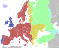
 EU trading partners map

Article(s): en:List of the largest trading partners of the European Union
- Request
- Can the map be edited to change the colour of the UK to the same as the USA as the UK is no longer a part of the EU please? --The C of E (talk) 17:47, 17 September 2024 (UTC)
- Graphist opinion(s)
- @The C of E: This map reflects data at 2015 when the United Kingdom was then a part of the European Union. J. Dann (talk) 13:22, 29 September 2024 (UTC)
Vectorize raster map file
[edit]-
 Raster logo file
Article(s): Heartland Flyer
- Request
- Hi! Please vectorize this raster map file. Thank you! --OrdinaryScarlett (talk) 09:02, 2 October 2024 (UTC)
- Graphist opinion(s)
Rio de Janeiro public transport map
[edit]-
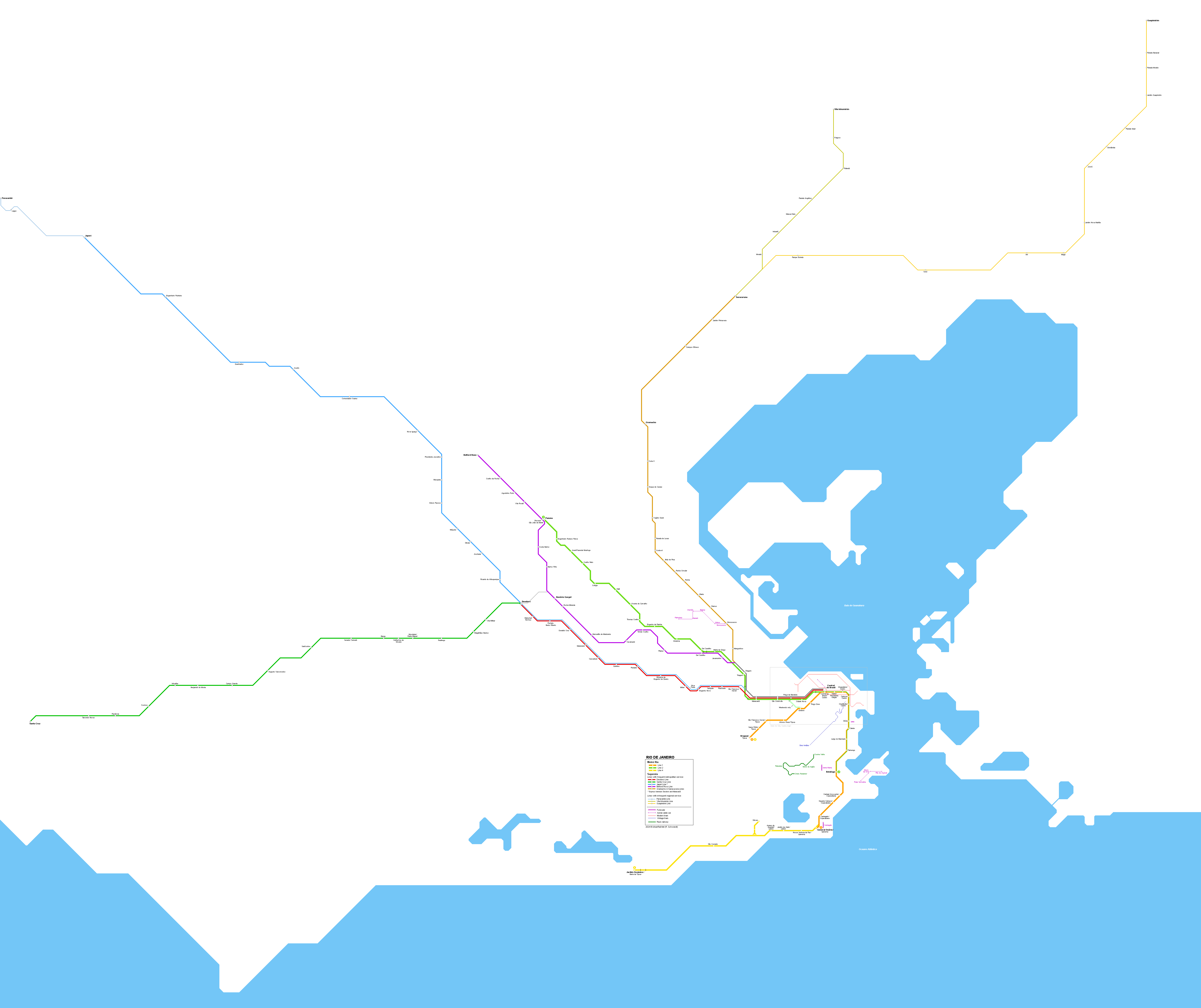
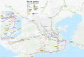 Public transport map of Rio de Janeiro

Article(s): over a hundred pages as can be seen on the picture page, for instance pt:TransBrasil
- Request
- There are several inconsistencies on this map, since the last update is from 2018. I will list them below:
Extended content
| ||
|---|---|---|
You can check current data on OpenStreetMap, as I (among other mappers) have it up-to-date there.--ArlindoPereira (talk) 08:35, 16 October 2024 (UTC)
I can do this but I will create a new map as a svg file, it will be so much easier to update in the future. I also will need your assistance/knowledge in the process of creating it.
|
@ArlindoPereira
Are we going to add more transportation's or can I start to fine adjusting?
Draft transport-13 --please ping me-- Goran tek-en (talk) 14:22, 15 December 2024 (UTC)
- @ArlindoPereira I made a mistake when posting the comment above so you have probably not got a ping, hope you get one now. --please ping me-- Goran tek-en (talk) 14:23, 15 December 2024 (UTC)
- @Goran tek-en looks really nice. I'd change the legend of Historical tram to Santa Teresa tram (it is historical, but that's more of a description than of a name), and similarly the other ones. Other than that it's very solid. --ArlindoPereira (talk) 14:14, 18 December 2024 (UTC)
- @Goran tek-en asked some friends in a public transport group to take a look on the current draft, here's some feedback from the community, that I didn't spot:
- There's a typo on BRT TransOeste legend, close to Line 4 subway (it is written Transoesta)
- On BRT TransBrasil, the section near station INTO, it is mapped as a binary, but in reality there's no such separation (both directions are on the same way).
- I noticed that stop wasn't properly mapped on OSM, just did it: https://www.openstreetmap.org/way/1343836282
- There is an interaction on BRT TransBrasil with BRT TransCarioca, that is similar to what happens with BRT TransCarioca and BRT TransOlímpica (that small branch near stations Curicica and Asa Branca). There is a viaduct from BRT TransBrasil, that starts between stations Rubens Vaz and Baixa do Sapateiro, and lands on TransCarioca close to station Santa Luzia. You can map it as a small branch of BRT TransBrasil, thus with red color. https://www.openstreetmap.org/way/578218039 --ArlindoPereira (talk) 17:53, 19 December 2024 (UTC)
- @ArlindoPereira
- Shall I begin with insets, legend and fine tuning? --please ping me-- Goran tek-en (talk) 18:37, 19 December 2024 (UTC)
- @Goran tek-en Yes I think so, other than those three points mentioned above, there is nothing to be changed.--ArlindoPereira (talk) 08:05, 20 December 2024 (UTC)
- @ArlindoPereira
- I have made the 3 last edits.
- I don’t think I have got all the names for the local tourist stuff.
- In inset 3. Check the positions and everything as it looks different when zoomed in. I have also made edits on the main map in this area, also check.
- Cristiano Ottoni Pequena África, should this be on both vlt 2, 3 on base map and inset?
- Praia Formosa vlt 2, I must have made a mistake at the base map, double stations?
- Vlt 4 towards Terminal Intermoda Gentileza, I can't find the OSM for this part (so much info) so check om inset 1.
- Ccr Barcas, shall we not add Praça da Bica.
- I started to add a legend but I wasn’t sure if one with everything is needed as they are marked out pretty well?
- Draft transport-14 --please ping me-- Goran tek-en (talk) 14:46, 26 December 2024 (UTC)
- Hi @Goran tek-en, it looks really nice with the insets. First, replying your questions:
- Yes, Cristiano Ottoni Pequena África has stops from 3 VLT lines.
- Path towards Terminal Intermodal Gentileza looks correct.
- No double stations on Praia Formosa. There is a second platform but that is not open to public service, it is just extended to store trams that are waiting for next trip.
- No, the ferry to Praia da Bica is not official and should probably be removed from OSM at some point.
- It might be interesting to have the legend to group the different transports together, but it's up to you of course. Something similar to that example: https://www.tremdedados.com.br/mapa-rio-metropolitano-de-transportes/
- Remarks about the main map and Inset 1:
- On TransBrasil, you need to deduplicate that segment near INTO station, as it is not a binary. The same applies on the inset.
- On Praça XV / ferry station, I don't think we need to differentiate the 4 piers / embarkment points. It can be a single station for all 4 ferries, connected to the single station for VLT.
- Remarks about Inset 1 (downtown):
- There's a typo on subway station Saara / Presidente
bVargas - On Uruguaiana / Centro, syllable separation should is U-ru-guai-a-na, so to break in two lines, it should be "Uruguai-(line-break)ana/Centro". Though by the looks of it, it probably fits as "Uruguaiana/(line-break)Centro".
- Similarly, on VLT station Providência, syllable separation is Pro-vi-dên-cia.
- On Santa Teresa (historical) tram:
- Curvelo should be Largo do Curvelo
- Largo do Guimarães should be Largo dos Guimarães
- There's a typo on subway station Saara / Presidente
- Inset 2:
- On Corcovado rack railway, there's a bit of controversy on the final station name. Both OSM and Wikipedia mark it as "Cristo Redentor", though doing a bit of research, it seems that the station name in reality is "Corcovado", according to this photo it reads "Estação Corcovado" or "Corcovado station". I will fix OSM accordingly.
- Aerialway on Sugar Loaf mountain could have the stations named according to their "locality", i.e. station 1 (south west) could be "Praia Vermelha", station 2 + 3 could be both "Morro da Urca" and station 4 could be "Pão de Açúcar".
- On subway station General Osório / Ipanema, you can make both lines connect to the same station. The situation over there is: there are two stations / platforms underground, the one on the south is currently not in use; the one on the north is used by trains on "line 1 interconnected to line 4". Stupid naming, in reality they are the same line.
- Inset 3:
- It is missing one way arrows around Penha 1 and Penha 2 (arrows going east-west around Penha 1 and west-east around Penha 2).
- There could also be paid connection between train station Penha and BRT station Penha 1.
- On Funicular:
- "Plano Inclinado Padre Laércio Dias de Moura" is a mouthful. Yes it is the official name but no one calls it by that, including official signage. Please name it "Bondinho da Penha".
- Please connect the south station of the "vertical segment" with the east station of the "horizontal segment" as free integration, as they're basically the same "station".--ArlindoPereira (talk) 23:45, 28 December 2024 (UTC)
- @ArlindoPereira
- On TransBrasil, you need to deduplicate that segment near INTO station. If you want me to remove a part you have to tell me which part.
- legend, name brt?
- legend. Some names appear two times, in logos and in text “boxes”, texts?
- Draft transport-15
- --please ping me-- Goran tek-en (talk) 18:42, 29 December 2024 (UTC)
- Hi @Goran tek-en, it looks really nice with the insets. First, replying your questions:
- @ArlindoPereira
- @Goran tek-en Yes I think so, other than those three points mentioned above, there is nothing to be changed.--ArlindoPereira (talk) 08:05, 20 December 2024 (UTC)
- @Goran tek-en asked some friends in a public transport group to take a look on the current draft, here's some feedback from the community, that I didn't spot:
- @Goran tek-en looks really nice. I'd change the legend of Historical tram to Santa Teresa tram (it is historical, but that's more of a description than of a name), and similarly the other ones. Other than that it's very solid. --ArlindoPereira (talk) 14:14, 18 December 2024 (UTC)
Map of Hadhrami migrations
[edit]-
Description of first image
Article(s): w:Hadhramaut, w:Hadharem
- Request
- I need an SVG map of the Hadhrami migrations in Asia and Africa based on this screenshot of the book "On the Edge of Empire : Hadhramawt, Emigration, and the Indian Ocean, 1880s-1930s" --Abo Yemen✉ 17:10, 12 November 2024 (UTC)
- areas per the book-
Arabian peninsula: Mecca Province, Medina Province, Jazan Province, Kuwait, Abu Dhabi
Africa: Cairo, Port Sudan, Suakin, Omdurman, Khartoum, the East Africa region (Kenya, Tanzania)
Islands: Zanzibar, Madagascar, Socotra
India: Kerala, Hyderabad
South East Asia is already clear on the map attached Abo Yemen✉ 17:34, 12 November 2024 (UTC)
- areas per the book-
- Graphist opinion(s)
- @Abo Yemen: Hi,
- Don't you think it will be better to start your pages before any graphist works on your editing request?
- Yours, En rouge (talk) 15:17, 30 November 2024 (UTC)
- They already exist tho, i just dont know why it wont link Abo Yemen✉ 15:42, 30 November 2024 (UTC)
- just fixed the links Abo Yemen✉ 15:43, 30 November 2024 (UTC)
- They already exist tho, i just dont know why it wont link Abo Yemen✉ 15:42, 30 November 2024 (UTC)
Opinion polling on the whether the United Kingdom should rejoin the European Union
[edit]
Article(s): Potential re-accession of the United Kingdom to the European Union
- Request
- Can someone please update this graph? The relevant opinion polling is on the above Wikipedia under "Article(s). Helper201 (talk) 20:25, 14 November 2024 (UTC)
- Graphist opinion(s)
Eurozone map
[edit]
Article(s): hu:Konvergenciakritériumok (Európai Unió)
- Request
- Hi, I would like to know if the update of this map should be recommended or not (e.g. the file is not svg). If yes, could you please create a new 2024 version with the following changes:
- Croatia should be blue (Eurozone member)
- the UK should be white (not EU member)
- Bulgaria should be in gold (ERM II member)
- Bosznia should be replaced by Bosznia-Hercegovina
- Thank you in advance! Bencemac (talk) 15:29, 24 November 2024 (UTC)
- Graphist opinion(s)
- @Bencemac: Hi,
- I think it is a great opportunity to start a svg file, rather than editing any png one.
- I've found some svg maps, with or without text:
- File:Europäische Wirtschafts- und Währungsunion 2.svg
- File:Eurozone_main_map.svg
- File:Eurozone Internal.svg
- Category:SVG maps of the European Union
- ...
- I think it's up to you to find the appropriate svg base map, to be able to answer your request.
- You can browse categories, here in Commons, and even find some other svg files in Wikipedia pages, about en:Eurozone or en:Euro convergence criteria (or whatsoever), in other languages.
- Yours, En rouge (talk) 15:10, 30 November 2024 (UTC)
Iraq Kurdistan political map
[edit]Article(s): Iraqi Kurdistan
- Request
- (Can anyone create a version of this map? Taken from this article. Ideally, we would have an English, Arabic and Kurdish version also. --الدبوني (talk) 07:17, 26 November 2024 (UTC)
- Graphist opinion(s)
- الدبوني: We have File:Kurdistan governorates 2015.png/File:Kurdistan governorates 2015-ar.png. Those will probably work well with appropriate captions. (The border of the east two governates is different but that doesn't affect the use at hand.) CMD (talk) 09:36, 29 November 2024 (UTC)
- @الدبوني and Chipmunkdavis: Hi,
- Displaying the map, if you click on Datawrapper under the map, you get a new display. Then this new map is composed thanks to an embedded svg. Copying/pasting this code will directly give a svg file (with probably some workaround).
- Copyright from OpenStreetMap contributors give a license compatible with uploading to Commons (to be confirmed).
- Yours, En rouge (talk) 14:09, 30 November 2024 (UTC)
- @الدبوني: Hi,
- Don't you think it will be better to start your page before any graphist works on your editing request?
- En rouge (talk) 15:15, 30 November 2024 (UTC)
Correct Green Valley, IL map to put circular emphasis on right municipality
[edit]-
 Highlighting is on wrong village

Article(s): en:Green Valley, Illinois
- Request
- The red circle is on the wrong village. It needs to be moved over to where Green Valley actually is (towards the bottom left). Thanks! --WhisperToMe (talk) 18:55, 1 December 2024 (UTC)
- Graphist opinion(s)
- WhisperToMe The 02:49, 28 October 2017 version seems to have the circle in the right place, but there is a square that changes color. Which square color is correct? CMD (talk) 00:24, 2 December 2024 (UTC)
- @Chipmunkdavis: The red settlement (the others are gray) is the correct location. The map is supposed to depict Green Valley, seen here. Compare with Tazewell County here. The circle is instead over Armington (which is depicted here: File:Tazewell_County_Illinois_Incorporated_and_Unincorporated_areas_Armington_Highlighted.svg). The circle is supposed to emphasize Green Valley. WhisperToMe (talk) 01:05, 2 December 2024 (UTC)
- That does seem to suggest the 02:49, 28 October 2017 has the correct circle, but do you know what to do with the square? ie. can this be reverted, or does a new version have to combine the old circle and new square? CMD (talk) 01:08, 2 December 2024 (UTC)
- @Chipmunkdavis: I see. The square should be en:Heritage Lake, Illinois (a census-designated place) based on the placement. I'm not really sure why it is not filled in with gray. I checked File:Harris County Texas incorporated and unincorporated areas Cloverleaf highlighted.svg and I notice some census-designated places are filled in with grey but some are not. Maybe I should ping the uploader and ask them if CDPs are supposed to be gray or white. WhisperToMe (talk) 01:59, 2 December 2024 (UTC)
- If it is, just revert to 02:49, 28 October 2017. If not, should be easy enough to combine the two.
- CMD (talk) 02:09, 2 December 2024 (UTC)
- @Chipmunkdavis: I see. The square should be en:Heritage Lake, Illinois (a census-designated place) based on the placement. I'm not really sure why it is not filled in with gray. I checked File:Harris County Texas incorporated and unincorporated areas Cloverleaf highlighted.svg and I notice some census-designated places are filled in with grey but some are not. Maybe I should ping the uploader and ask them if CDPs are supposed to be gray or white. WhisperToMe (talk) 01:59, 2 December 2024 (UTC)
- That does seem to suggest the 02:49, 28 October 2017 has the correct circle, but do you know what to do with the square? ie. can this be reverted, or does a new version have to combine the old circle and new square? CMD (talk) 01:08, 2 December 2024 (UTC)
- @Chipmunkdavis: The red settlement (the others are gray) is the correct location. The map is supposed to depict Green Valley, seen here. Compare with Tazewell County here. The circle is instead over Armington (which is depicted here: File:Tazewell_County_Illinois_Incorporated_and_Unincorporated_areas_Armington_Highlighted.svg). The circle is supposed to emphasize Green Valley. WhisperToMe (talk) 01:05, 2 December 2024 (UTC)
Roger Waters' Berlin Wall concert
[edit]Article(s): en:The Wall – Live in Berlin
- Request
- Please will sone kindly take a modern map of the relevant part of Berlin city centre, and overlay the perimeter and stage ("Bühne") of the above concert, based on the diagram seen part-way down this web page? Andy Mabbett (Pigsonthewing); Talk to Andy; Andy's edits 17:40, 4 December 2024 (UTC)
- Graphist opinion(s)
 Request taken by --please ping me-- Goran tek-en (talk) 16:56, 14 December 2024 (UTC)
- @Pigsonthewing
- I'm using OSM as source for the background map, but how detailed do you want this map, try to explain, thanks. --please ping me-- Goran tek-en (talk) 14:35, 15 December 2024 (UTC)
- @Goran tek-en: As detailed as the source image; any more would be original research. Thank you. Andy Mabbett (Pigsonthewing); Talk to Andy; Andy's edits 16:16, 15 December 2024 (UTC)
- @Pigsonthewing
- ----
- Those drafts are PNG versions of the original SVG file I'm working in and will upload to commons.
- Those drafts are shown for proofreading only.
- ----
- I assumed you wanted to see the underlying map under the area. Did you want the entrances marked out, texts for them and stage...
- Give me feedback, thanks.
- Draft concert-1 --please ping me-- Goran tek-en (talk) 19:22, 19 December 2024 (UTC)
- @Pigsonthewing Could you check the draft above and give me feedback, thanks. --please ping me-- Goran tek-en (talk) 18:26, 23 December 2024 (UTC)
- @Goran tek-en: Sorry, I wrote a reply the other day, but clearly didn't save it. That looks good, thank you. Maybe make the outlining a little heavier - it's hard to see the stage, for instance. The stage needs a label (or at least a symbol which can be labelled in the caption, to keep things multilingual). Symbols for the entrances, too, please. Andy Mabbett (Pigsonthewing); Talk to Andy; Andy's edits 19:33, 23 December 2024 (UTC)
- @Pigsonthewing
- I don't really understand what you mean with the stage symbol/label.
- Draft concert-2 --please ping me-- Goran tek-en (talk) 12:52, 24 December 2024 (UTC)
- @Goran tek-en: Rather than using the English word "stage", which is of no use in other languages, please use a symbol, like "‡" (or even "S"), which can be used in the caption alongside the word for "stage" in whichever langauge is needed. Andy Mabbett (Pigsonthewing); Talk to Andy; Andy's edits 13:39, 24 December 2024 (UTC)
- @Pigsonthewing Draft concert-3 --please ping me-- Goran tek-en (talk) 15:43, 24 December 2024 (UTC)
- @Goran tek-en: That looks great, thank you. Please will you add the other two, accessible (wheelchair-symbol) entrances? Then I think we are good to go. Andy Mabbett (Pigsonthewing); Talk to Andy; Andy's edits 15:56, 24 December 2024 (UTC)
- @Pigsonthewing
- Draft concert-4
- If this is fine I will need the following;
- Name of the file
- Description (/language)
- Captions/s (/language)
- Category/ies at commons
- Structured data/Items portrayed in this file, the Q#, to be able to upload it at commons, thanks.
- --please ping me-- Goran tek-en (talk) 11:49, 25 December 2024 (UTC)
- @Goran tek-en: That looks great, thank you. Please will you add the other two, accessible (wheelchair-symbol) entrances? Then I think we are good to go. Andy Mabbett (Pigsonthewing); Talk to Andy; Andy's edits 15:56, 24 December 2024 (UTC)
- @Pigsonthewing Draft concert-3 --please ping me-- Goran tek-en (talk) 15:43, 24 December 2024 (UTC)
- @Goran tek-en: Rather than using the English word "stage", which is of no use in other languages, please use a symbol, like "‡" (or even "S"), which can be used in the caption alongside the word for "stage" in whichever langauge is needed. Andy Mabbett (Pigsonthewing); Talk to Andy; Andy's edits 13:39, 24 December 2024 (UTC)
- @Goran tek-en: Sorry, I wrote a reply the other day, but clearly didn't save it. That looks good, thank you. Maybe make the outlining a little heavier - it's hard to see the stage, for instance. The stage needs a label (or at least a symbol which can be labelled in the caption, to keep things multilingual). Symbols for the entrances, too, please. Andy Mabbett (Pigsonthewing); Talk to Andy; Andy's edits 19:33, 23 December 2024 (UTC)
- @Pigsonthewing Could you check the draft above and give me feedback, thanks. --please ping me-- Goran tek-en (talk) 18:26, 23 December 2024 (UTC)
- @Goran tek-en: As detailed as the source image; any more would be original research. Thank you. Andy Mabbett (Pigsonthewing); Talk to Andy; Andy's edits 16:16, 15 December 2024 (UTC)
@Goran tek-en: What a great Chrsitmas present! Thank you. Please upload as "File:Roger waters Berlin Wall concert arena overlaid on 2024 map", with:
|caption=en: Roger Waters' Berlin Wall concert arena, overlaid on a 2024 OpenStreetMap map|description= en: Roger Waters' Berlin Wall concert arena, overlaid on a 2024 OpenStreetMap map (Brandenburg Gate, top right; Potsdamer Platz, bottom right). ‡ = stage.- Categories:
[[Category:The Wall - Live in Berlin]] [[Category:Category:1990 maps of Berlin]] [[Category:2024 maps of Berlin]]
I will sort out SDC later, as new item(s) will have to be created. Andy Mabbett (Pigsonthewing); Talk to Andy; Andy's edits 12:29, 25 December 2024 (UTC)
- Andy Mabbett Now you can find it here file:Roger waters Berlin Wall concert arena overlaid on 2024 map.svg.
- Yes, the SDC needs more info.
- Under:
{{Information
 |description    ={{en|x}}
you can add
{{Institution |wikidata=Qx}}, one template for each Qx.
- If you are happy with this please put the code
"{{section re.solved|1=~~~~}}"(without the ".") on this request so it can be archived, thanks. Done --please ping me-- Goran tek-en (talk) 18:50, 25 December 2024 (UTC)
French Indochina administrative divisions in 1937
[edit]-
 English version
 -
 French version


Article(s): [[]]
- Request
- I would like to have some changes on the máp:
- Some provinces seem to be missing from the map, such as Hà Nam province (shows as part of Nam Định province) and Phúc Yên province (shows as part of Vĩnh Yên province)
- I think that military teritories are also provinces, so they can named with their own names rather than just numbered territories (display within each other or just one type, 1e = Hải Ninh, 2e = Cao Bằng, 3e = Hà Giang, 4e = Lai Châu, 5e = Phongsaly)
- For English version, I think some provinces in Annam, Laos, a province in Tonkin (Pho Tuo = Phú Thọ), a province in Cambodia (typo I think: Svai Rieng = Svay Rieng) should be called with Vietnamese/Lao names rather than how the French at that time call it (Vinh = Nghệ An, Đồng Hới = Quảng Bình, Huế = Thừa Thiên, Tourane = Quảng Nam, Qui Nhơn = Bình Định, Sông Cầu = Phú Yên, Nha Trang = Khánh Hòa, Phan Rang = Ninh Thuận, Phan Thiết = Bình Thuận, Buôn Ma Thuột = Đắk Lắk, Đà Lạt = Đồng Nai Thượng (Đà Lạt has its own province-level special administrative region which can be shown in this map) and some provinces of Laos: Haut-Mekong = Houa Khong, Trấn Ninh = Houaphanh, Cammon = Khammuane, Bassac = Champasack/Champasak). It's optional in French version due to differences between how the French governors named it back then and how the French speaker call it now (if the French version is also need to change, Đồng Nai Thượng = Haut-Đồng Nai)
- Border between Thanh Hóa province and Nghệ An province (shows as Vinh) with Laos seems not right due to that border kept until now but looks different from the current one, so I need Thanh Hóa to have a small land point into Laos and west Nghệ An looks sharper, thanks! --Khanh ( talk | contribs | CA | vi ) 13:19, 10 December 2024 (UTC)
- Graphist opinion(s)
IUCN-based range map for a mantis
[edit]Article(s): en:Rivetina baetica
- Request
- Hi, I would very much appreciate it if someone with the proper software and know-how made a range map based on the IUCN Red List data [2] for Rivetina baetica. Thanks, Cremastra (talk) 22:57, 18 December 2024 (UTC)
- Graphist opinion(s)
- Request taken. The style will be similar to other IUCN range maps M.Bitton (talk) 01:52, 19 December 2024 (UTC
- Done M.Bitton (talk) 10:32, 20 December 2024 (UTC)

.svg)
.svg)
 Thank you., En rouge (talk) 18:54, 29 December 2024 (UTC)
- @M.Bitton Lovely, thank-you. Cremastra (talk) 19:10, 29 December 2024 (UTC)